Landmeld API
Request any place on Earth as terrain from your own tools.


A native Unreal plugin, open formats for everything else, and a CLI for your pipeline.
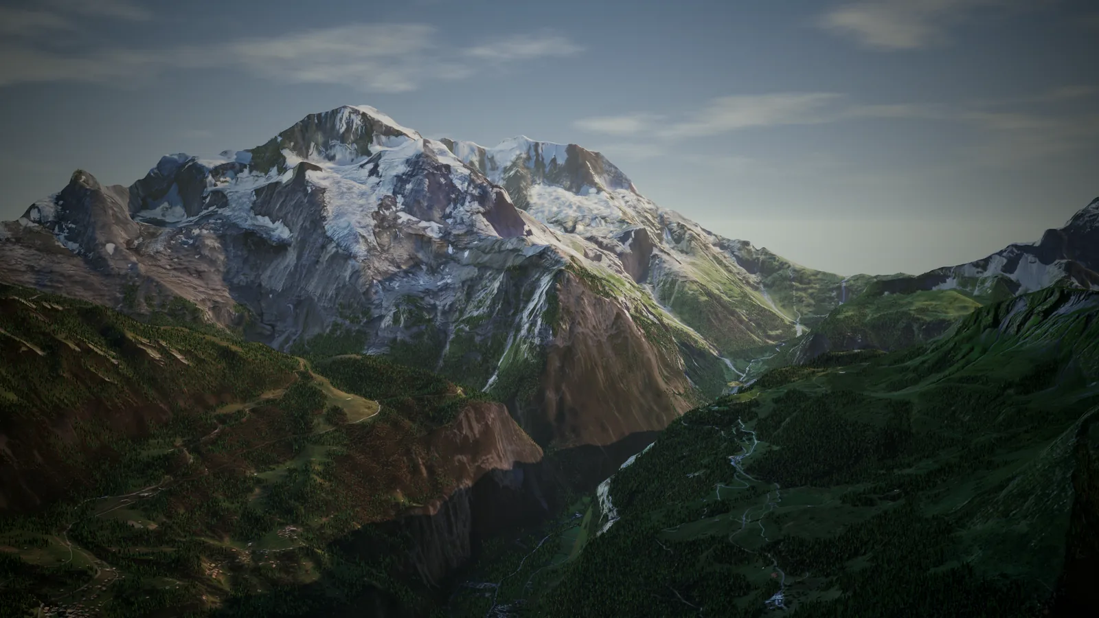
Landscape, paint layers and water masks land in Unreal in one click. Re-shape in Landmeld, the level updates.
Draw the area on the globe. Elevation, imagery and map data come down with it.
Export straight into the open project, with no files to move by hand.
Landscape, paint layers and water are set up in the level.
16-bit height, split into World Partition tiles.
Weight maps from land cover, one per paint layer.
Masks and depth for lakes, rivers and coast.
The aerial or shaded color for the Landscape material.
Re-shape in Landmeld, the level updates.
| Supported | Tested | |
|---|---|---|
| Unreal Engine | To be confirmed | To be confirmed |
| Windows | To be confirmed | To be confirmed |
| macOS | To be confirmed | To be confirmed |
| Linux | To be confirmed | To be confirmed |
| Landmeld app | To be confirmed | To be confirmed |
Pick a tool to see which formats it takes.
Game engines
 Unreal Engine
Formats: PNG 16-bit · GLB

Unity
Formats: FBX · RAW / R16 · GLB
GLB through a glTF package
 Godot
Godot
Formats: GLB
 O3DE
O3DE
Formats: GLB · PNG 16-bit

Flax
Formats: GLB · PNG 16-bit

Stride
Formats: FBX · OBJ
3D & DCC

Blender
Formats: GLB
 Houdini
Formats: GLB · EXR
Maya
Formats: FBX · OBJ · USD / USDZ
3ds Max
Formats: FBX · OBJ
 Cinema 4D
Formats: FBX · OBJ
Terrain tools

Gaea
Formats: RAW / R16 · EXR · GeoTIFF · PNG 16-bit

World Machine
Formats: RAW / R16 · EXR · GeoTIFF · PNG 16-bit
 World Creator
Formats: RAW / R16 · EXR · GeoTIFF · PNG 16-bit
Instant Terra
Formats: RAW / R16 · EXR · GeoTIFF · PNG 16-bit
Viz & AEC
 Twinmotion
Formats: FBX · OBJ

Lumion
Formats: FBX · OBJ

Enscape
Formats: FBX · OBJ

D5 Render
Formats: FBX · OBJ
 SketchUp
Formats: DAE (Collada) · OBJ
 Rhino
Rhino
Formats: OBJ · FBX
Revit
Formats: IFC
Web & 3D viewers
 Three.js
Formats: GLB
 Babylon.js
Formats: GLB
 PlayCanvas
Formats: GLB
 model-viewer
Formats: GLB
 Sketchfab
Formats: GLB

Cesium
Formats: 3D Tiles
Simulation
Omniverse
Formats: USD / USDZ
Isaac Sim
Formats: USD / USDZ
 CARLA
CARLA
Formats: FBX · OpenDRIVE (.xodr)

Gazebo
Formats: DAE (Collada) · OBJ · SDF world · PNG 16-bit · GeoTIFF
and more
Tiled at true scale, georeferenced, up to whole regions.
Meshes
Tiled 3D mesh with the aerial texture inside, in one file.
Unreal Engine, Unity, Godot, Blender, Three.js and 7 more
The same mesh as separate JSON, binary and texture files.
Mesh for Unity, the Autodesk tools and most viz apps.
Unity, Stride, Maya, 3ds Max, Cinema 4D and 6 more
Plain mesh that nearly every 3D tool opens.
Stride, Maya, 3ds Max, Cinema 4D, Twinmotion and 6 more
Open XML mesh format with materials.
SketchUp, Gazebo
Scene format for simulation and film pipelines.
Maya, Omniverse, Isaac Sim
Heightmaps
Height in 65,536 steps, tiled and sized for Unreal Landscape.
Unreal Engine, O3DE, Flax, Gaea, World Machine and 3 more
Headerless 16-bit height, as Unity Terrain and terrain tools read it.
Unity, Gaea, World Machine, World Creator, Instant Terra
32-bit float height, with no stepping.
Houdini, Gaea, World Machine, World Creator, Instant Terra
Height with its coordinates written into the file.
Gaea, World Machine, World Creator, Instant Terra, Gazebo
Textures & masks
The aerial or shaded color as its own texture.
Surface detail from the height, for lighting in engine.
One weight per terrain layer, to paint materials.
One mask per land cover class, such as water, forest or rock.
Web & GIS
Streamed tiles with levels of detail, for web globes.
Cesium
Simulation & AEC
Road network description for driving simulators.
CARLA
Gazebo world file with the terrain and its models.
Gazebo
Open BIM format, for site context in Revit.
Revit
Project
The Landmeld project. Open it again and re-shape any time.
Landmeld
Batch whole regions from a script and plug Landmeld into your build pipeline.
# Download Emerald Bay with its map datalandmeld-cli --center-lat 38.95 --center-lon -120.11 --width-m 4000 --height-m 3500 --map water,land --output emerald_bay.land# Re-shape it, export tiled GLBlandmeld-cli --open emerald_bay.land --surface winter.json --output emerald_bay.glbRequest any place on Earth as terrain from your own tools.